Living in Wesley Heights, Charlotte NC (2026)
Historic bungalow streets climbing west from Uptown, caught between preservation and a fast-moving infill wave.
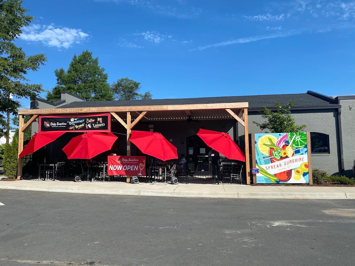
Ruby Sunshine
About the area
Wesley Heights climbs the hill just west of Uptown, one of the city's oldest streetcar suburbs, platted in the early 1900s along what was then the Seaboard Air Line. Craftsman bungalows and foursquares line streets like Toomey Avenue and Woodruff Place, many restored over the past two decades as buyers priced out of South End and Dilworth moved west. The neighborhood's edges tell two different stories: near Uptown, walkable blocks and adaptive-reuse projects like Savona Mill are pulling in office tenants and evening foot traffic; toward Rozzelles Ferry Road, older rental stock and scattered vacant lots still mark a slower recovery.
Stewart Creek Greenway threads through the western half, linking to Camp Greene and a planned expansion of Bryant Park. The result is a neighborhood in transition, still affordable relative to inner-ring peers east of Uptown, but no longer the overlooked pass-through it was a decade ago.
Quick facts
Neighborhood vs Charlotte citywide. Walkability is rated Green / Orange / Red from its percentile among Charlotte planning areas.
| Metric | This area | Charlotte citywide |
|---|---|---|
| Median home sales price | $406,339 | $489,824 |
| Median household income | $94,768 | $98,184 |
| Median age | 31.2 | 36.4 |
| Population | 3,911 | 1,154,681 |
| Walkability (EPA) | 14.9Strong | 10.4Typical |
Demographics
Figures come from the U.S. Census Bureau's American Community Survey (ACS) 5-year estimates for Wesley Heights vs Charlotte citywide. ACS is an ongoing Census survey; the 5-year product pools recent responses so smaller neighborhoods have more stable estimates than a single year.
| Metric | This area | Charlotte citywide |
|---|---|---|
| Median household income | $94,768 | $98,184 |
| Median age | 31.2 | 36.4 |
| Population | 3,911 | 1,154,681 |
| Owner-occupied | 41.6% | 57.2% |
Amenities
City of Charlotte proximity scores, EPA walkability, and city crime rates for Wesley Heights vs Charlotte citywide. Each figure is rated Green / Orange / Red from its percentile among Charlotte planning areas (configurable in admin). Crime rates are reported-incident indicators, not a safe/unsafe verdict. Read how to read Charlotte crime rates and methodology.
- Grocery proximity
- 9.9Typical
Charlotte 37.5Typical
- Transit proximity
- 100Typical
Charlotte 74.4Typical
- Tree canopy
- 19.8Typical
Charlotte 46.7Typical
- Walkability
- 14.9Strong
Charlotte 10.4Typical
- Violent crime rate
- 8.7Weak
Charlotte 4.4Typical
- Property crime rate
- 99.4Weak
Charlotte 32.9Typical
City of Charlotte
City of Charlotte
City of Charlotte
EPA
City of Charlotte
City of Charlotte
Reading the data
Charlotte's Quality of Life Explorer puts Wesley Heights' median home sales price at $418,373, about 12% below the citywide figure of $474,833. That gap reflects a mix of unrenovated early-1900s housing alongside newer infill, population-weighted across the planning areas in our crosswalk rather than pulled from MLS records. Household income tells a different story: ACS estimates put median household income at $108,892, roughly 15% above the citywide median of $94,896, pairing below-average home prices with above-average incomes, an unusual combination that suggests either high-earning renters or recent buyer turnover outpacing the sales data.
Walkability sits at 12.1 versus a citywide 10.6, consistent with a compact, sidewalk-gridded streetcar suburb close to Uptown. A population estimate of 3,685 and median age of 44.1 point to an established, non-student population.
Compared with neighboring Seversville, which sits immediately west along similar Rozzelles Ferry Road frontage, Wesley Heights generally shows a more advanced renovation cycle and stronger walkability. Third Ward, closer to Uptown's office core, typically posts higher walk scores and price levels, showing how proximity to Uptown drives block-by-block variation.
Relocation notes
Wesley Heights suits buyers who want Uptown proximity without Uptown or South End pricing, and who are comfortable with a neighborhood still mid-renovation. Rozzelles Ferry Road and Toomey Avenue connect to Uptown in about 10 minutes off-peak, and Stewart Creek Greenway offers a car-free route toward Camp Greene and, once Bryant Park's planned upgrade is complete, a longer connected trail network.
Expect a mix of restored Craftsman bungalows, some still-original rental housing, and scattered new construction, so lot-by-lot condition varies more than neighborhood-wide averages suggest. Renters should note recent scrutiny of room-by-room rental conversions on Woodruff Place, since zoning enforcement can shape what's buildable nearby. Compare Wesley Heights against Seversville, Third Ward, and Wilmore before making an offer.
Data limitations
This profile is informational, not real estate, legal, or investment advice. Wesley Heights' planning-area boundaries may not match every neighborhood association or MLS subdivision map, and QoL sales indicators and ACS demographics lag current market conditions by one to two years. Small-area ACS figures carry meaningful margin of error. Zillow ZHVI is withheld pending licensing, so housing figures reflect QoL sales data only. Questions or corrections: contact us via /contact.
Research Wesley Heights by goal
Match lifestyle, budget, or hazard questions to Charlotte-wide guides, then return to this profile for local tables and map deep links.
Nearby schools
Charlotte-Mecklenburg Schools (CMS) campuses near Wesley Heights. Exact assignment depends on your address. Verify with the CMS school locator and NC DPI report cards for ratings. We list names and levels only.
Elementary
- Bruns Avenue0.7 mi
- Ashley Park Pre K-81.2 mi
- Irwin Academic Center1.3 mi
Middle
- Jt Williams Secondary Montessori1.9 mi
- Sedgefield2.4 mi
High
- Phillip O. Berry Academy Of Technology1.4 mi
- Harding University1.9 mi
- Northwest School Of The Arts2.0 mi
FAQ
What is the median home price in Wesley Heights, Charlotte NC?
According to City of Charlotte home sales data as of 2023, Wesley Heights has a median home sales price of about $406,339, compared with roughly $489,824 Charlotte citywide. Figures are city sales indicators, not an MLS median.
What is the median household income in Wesley Heights?
U.S. Census Bureau American Community Survey (ACS) 5-year estimates for Wesley Heights show a median household income of about $94,768 (ACS 2024) (Charlotte citywide ≈ $98,184). Small-area ACS estimates have sampling error; treat as directional.
How walkable is Wesley Heights?
For Wesley Heights, the EPA National Walkability Index is 14.9 on a 1–20 scale (Green: Strong among Charlotte planning areas), EPA vintage 2021. Walkability: Green (Strong) vs Charlotte NPAs — higher scores rank better. Open the walkability layer on the map for spatial context.
Is Wesley Heights a good place to live in Charlotte?
Fit depends on budget, commute, and priorities. Wesley Heights’s median sales price ($406,339) compares to the Charlotte citywide figure ($489,824). Use Know Charlotte to compare demographics, walkability, and adjacent neighborhoods; we report public data, not buy/sell advice.
Where is Wesley Heights on the Charlotte map?
Open the interactive Charlotte neighborhood map and jump to this area via the explore link on this page. Map selection uses planning area 51; see methodology for how named neighborhoods relate to official planning boundaries.
Nearby & similar
Similar housing & demographics
Closest on price, income, age, and walkability (excluding nearby)
Explore on the interactive map
Sources: Data sources · Methodology. Page reviewed 2026-09-05.